Click on the terms in red for definitions and explanations.
Arriving in Zekharia, 20 kilometres southwest of Jerusalem, you might not think that the modern Israeli town has much to tell about Palestine’s Arab history. When you find the traces of deeper roots – the half-ruined mosque and the handful of older buildings scattered among the 1960s and 1970s villas, themselves overshadowed by new construction in the nearby city of Beit Shemesh – you might wonder what this place once was, who lived here, and what happened to them. But nothing answers your questions in today’s Zekharia.
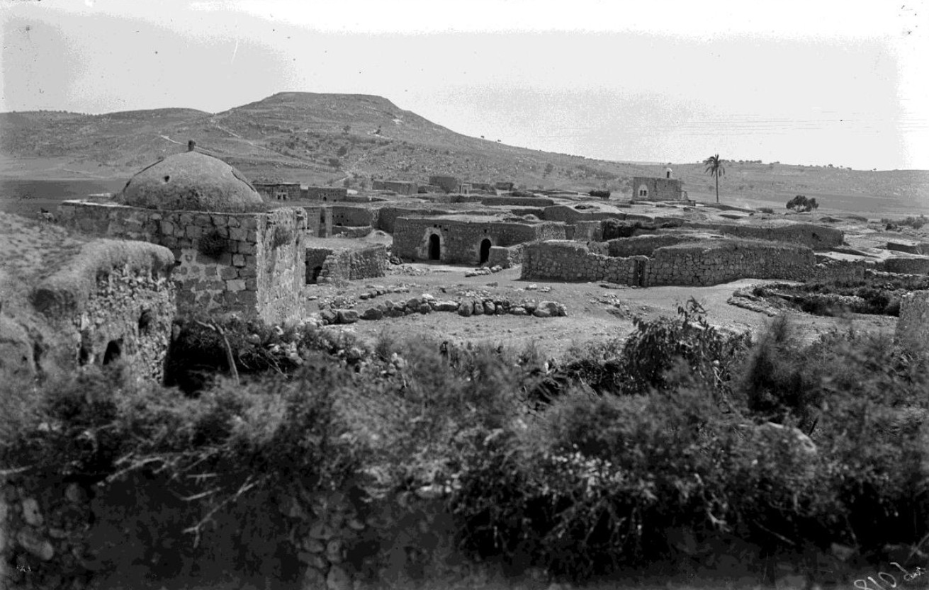
Located in the middle of the country, between Gaza and Jerusalem, between the coast and the mountains, the story of Zakariyya – as its Arab inhabitants and their descendants call this place – “is the story of the Palestinian question, of the homeland, of pain and of loss” (Khader Salameh). People have lived in or near Zakariyya possibly since it was a Canaanite village in the Bronze Age, up to 5000 years ago. The location marks the boundary between Palestine’s flat coastal plain to the west, with fertile agricultural land, and the mountains around Jerusalem in the east, which offered greater security for villages. Southwest of the village is a hill called Tel ʿAzekah. Over time, the location of Zakariyya may have shifted from the top of Tel ʿAzekah to the site of the Palestinian village. One of the oldest sources of this region’s history is the Bible, which mentions ʿAzekah several times.
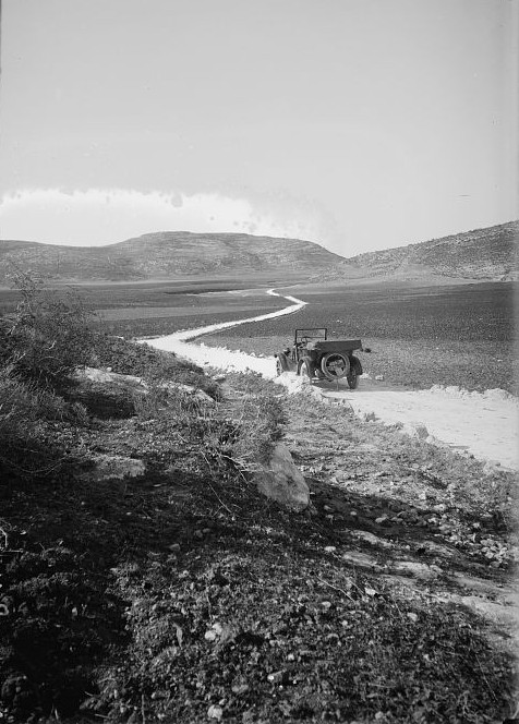
View of Tel ʿAzekah during the British Mandate era, by American Colony Photo Department. Courtesy of the Library of Congress, Prints & Photographs Division.
By the 5th century CE, Zakariyya’s inhabitants were Christian in faith, and spoke Greek. Palestine was part of the Roman or Byzantine Empire, which adopted Christianity in the 4th century. Close to Jerusalem and Bethlehem, Zakariyya began to host pilgrims on their way to the new religion’s holy places, particularly those on the road from Gaza, connecting North Africa to Palestine and Southwest Asia.
It wasn’t long before Zakariyya became a pilgrimage site in its own right. Around the year 415, a farmer from the village, named Calemeros, claimed to have been visited in his dreams by the Biblical figure of Zechariah. The figure directed Calemeros to a nearby garden, where he found a chest guarded by two snakes, and a glass of water. Inside the chest was a coffin, containing the body of Zechariah, miraculously intact and undecayed. Yet the question remained – just which Biblical Zechariah was this?
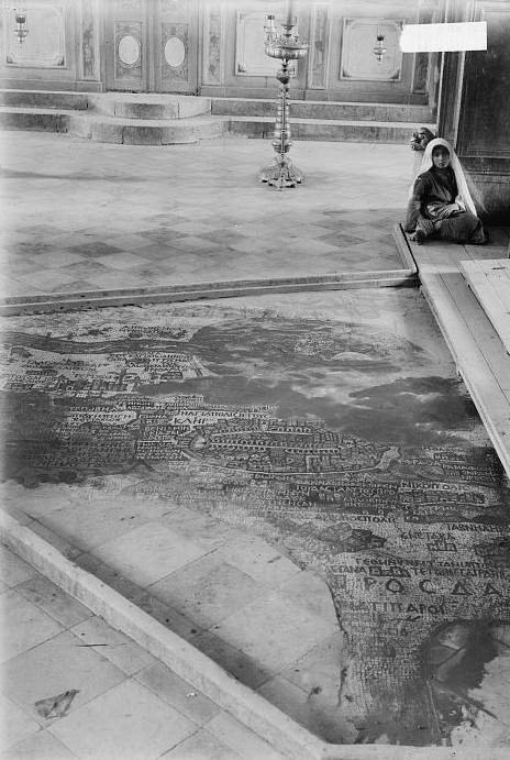
During the Byzantine era, a church was built in the village, dedicated to Saint Zechariah. An Italian pilgrim wrote that at Zechariah’s tomb, “there is now a lovely basilica, very well decorated, and with many servants of God.” We have a visual depiction of this basilica thanks to the Madaba mosaic map. On the map, a complex “of Saint Zechariah” appears, with a red-roofed portico in front, an upper gallery with three large windows or doors, and a semi-circular courtyard behind. Just to the left, we see a few houses cramped together, labelled “Beth Zachar”, the House of Zechariah, giving us a first glimpse of Zakariyya village.
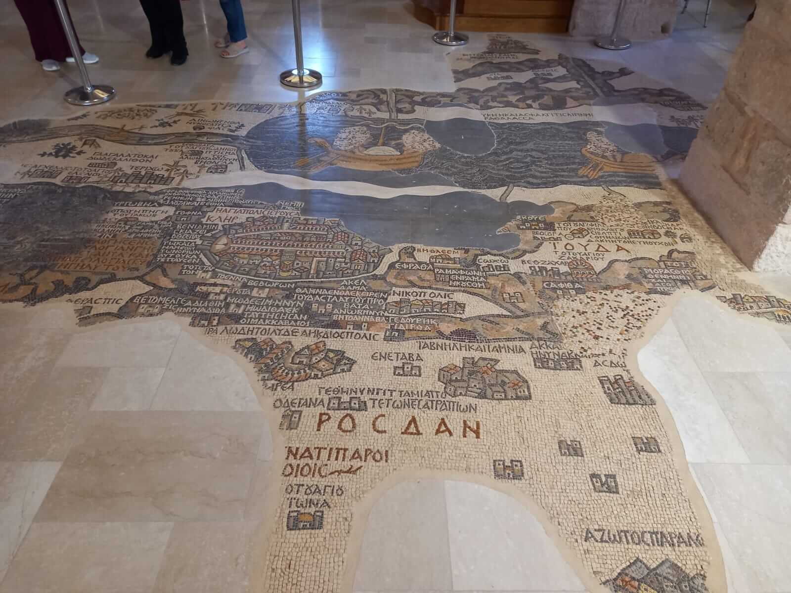
Madaba map. © Sami Aranki, 2026